Quiver Tree Forest Trail – Sesriem Travel Guide
From the stunning Quiver Tree Forest, continue your adventure to the tranquil Mount D Urban Campsite. This route takes you through changing landscapes, passing unique rock formations and open plains that highlight Namibia’s natural beauty. Upon arrival, enjoy the serenity of the site, ideal for camping under spectacular starry skies. The road distance between Quiver Tree Forest, located near Keetmanshoop, and Sesriem, the gateway to Sossusvlei, is approximately 520 kilometers. This journey typically requires between 7 and 8 hours of driving, depending on road and traffic conditions. Travel Guide for the Quiver Tree Forest – Sesriem Route: A True African Adventure.
Audio guide of the Quiver Tree Forest Route – Sesriem
- An interactive tour guide offers an enriching and dynamic experience, combining detailed information with modern technology.
- Our Namibia Travel App allows users to access maps, images, and real-time data, adapting to their preferences and pace.
- Interacting with the digital platform allows you to discover historical details, anecdotes, and unique recommendations, making each tour more immersive. Furthermore, its ability to offer multimedia content enhances the understanding and enjoyment of each point of interest, without the need to follow strict schedules or rely on a physical guide.
Audio Guide Quiver Tree Forest Route – Sesriem
Our self-guided audio tour offers complete flexibility and convenience to explore at your own pace. You can pause, rewind, or replay information whenever you need, allowing you to enjoy the tour without the pressure of a schedule or group. It also provides access to historical facts and interesting facts at any time of day, without depending on the availability of a guide. This makes it the ideal option for those looking for an informative and detailed experience, yet with complete freedom to explore.
What to see in the Audio Guide for the “Quiver Tree Forest Route – Sesriem”
Keetmanshoop
Keetmanshoop, located in the Karas Region of southern Namibia, is a town with a rich history dating back to before European colonization. Originally known as Nugoaes or “Black Swamp” in the local language, this name referred to a spring in the area. In 1860, the Rhenish Missionary Society established a mission with the aim of evangelizing the local Nama community. On April 14, 1866, missionary Johann Georg Schröder arrived in the area, a date considered the official founding of Keetmanshoop. The mission was named after Johann Keetman, a German merchant who funded the initiative, although he never visited the site himself.
During the South African occupation of Namibia, then known as South West Africa, Keetmanshoop played a significant role. During the apartheid era, the town served as the administrative capital of the Namaland Bantustan, a region designated for the Nama population under racial segregation policies.
The city is renowned for its historic architecture, most notably the Rhenish Mission Church, built in 1895, which now houses the Keetmanshoop Museum. This building was declared a national monument in 1978 and is a notable example of the combination of Gothic architecture and African stone.
Keetmanshoop is also known for its proximity to the Aloe dichotoma forest, also known as kokerboom, a species endemic to the region that attracts numerous tourists.
In economic terms, Keetmanshoop has been a vital center for Karakul sheep breeding and fur production, contributing significantly to the local economy. The town is also strategically located at the intersection of major transport routes, including the Trans-Namib Railway, which connects Windhoek with Upington in South Africa, consolidating its role as the economic hub of southern Namibia.
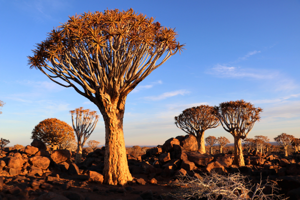
Quiver Tree Forest
The Quiver Tree Forest, known in Afrikaans as Kokerboom Woud, is a remarkable natural formation located in southern Namibia, approximately 14 kilometers northeast of Keetmanshoop, on the Gariganus farm. This forest is home to around 250 specimens of Aloidendron dichotomum, commonly called quiver or kokerboom trees, because Bushmen traditionally used their hollow branches to make quivers for their arrows.
The tallest quiver trees in this forest are between two and three centuries old, reflecting their resilience and adaptation to the desert environment. On June 1, 1995, the forest was declared a Namibian national monument, recognizing its ecological and cultural significance.
A distinctive feature of these trees is their “upside-down” appearance, as their leaves resemble roots, which has given rise to various local beliefs. Those who care for and worship these trees are said to receive good luck. Furthermore, there is a belief that if one of these trees is dug up, diamonds will be found in its place, but due to its sacred status, no one dares to do so.
Near the forest is Giant’s Playground, a vast accumulation of large diabase boulders that form a unique geological landscape and are attractive to visitors.
Ecologically, the Quiver Tree Forest is of great value. During June and July, the trees bloom with bright yellow flowers, attracting a variety of insects, birds, and mammals that feed on their abundant nectar. Among the fauna that inhabits the forest is the Cape hyrax, also known as the rock hyrax, which lives among the area’s rocks.
Although Aloidendron dichotomum is common in southern Africa, few natural forests of quiver trees exist. Most have been planted by humans, such as the one found in the Karoo Desert National Botanic Garden in Worcester, South Africa. However, the Keetmanshoop forest is a spontaneous formation, making it especially valuable from an ecological and conservation perspective.
Maltahöhe
Maltahöhe is a locality located in the Hardap Region of south-central Namibia, approximately 110 kilometers west of Mariental. Founded in 1899 by Henning von Burgsdorff, an officer in the German Schutztruppe, he named it after his wife, Malta.
Historically, Maltahöhe was a significant center for karakul sheep farming, a key economic activity in the region. However, in recent decades, the village has experienced an economic decline, with shop closures and a decline in commercial activity. Despite these challenges, Maltahöhe remains a point of interest for travelers heading to nearby tourist destinations such as Sossusvlei, Sesriem, and Duwisib Castle.
One of the town’s most notable buildings is the Maltahöhe Hotel, established in 1907, making it the oldest operating country hotel in Namibia. This establishment offers accommodation and services to visitors while maintaining its historic charm and traditional hospitality.
In terms of infrastructure, Maltahöhe has a primary school and Daweb Junior High School, although it lacks a full secondary school. The community has faced challenges related to unemployment and business migration, which has affected its economic and social development.
Despite these obstacles, Maltahöhe retains its relevance as a gateway to some of Namibia’s most impressive natural attractions, offering travelers a glimpse into German colonial history and local culture in an authentic rural setting.
Sesriem
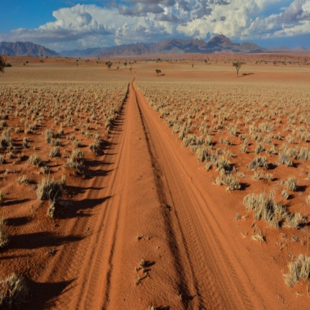
Sesriem is a small town located in the Namib Desert, in the Hardap Region of Namibia. Known primarily as the gateway to the Namib-Naukluft National Park, Sesriem is the access point for visiting the iconic Sossusvlei dunes and Sesriem Canyon.
The name “Sesriem” comes from the Afrikaans language and means “six leather straps,” referring to the time when pioneers used six leather straps tied together to draw water from the depths of the Sesriem Canyon.
The Sesriem Canyon, located about 4 km from the town, is a geological formation approximately one kilometer long and up to 30 meters deep, carved by the Tsauchab River over millions of years. This canyon offers visitors the opportunity to explore its narrow gorges and permanent pools of water, which serve as a vital source of water for local wildlife.
Sesriem offers basic services for travelers, including a gas station, supply stores, and accommodation options ranging from campsites to lodges. Its proximity to the Sossusvlei dunes makes Sesriem an ideal base for those wishing to explore the Namib Desert and its stunning landscapes.
In addition to hiking and canyon exploration, visitors can enjoy sunrise hot-air balloon rides, offering panoramic views of the dunes and the vast desert stretching to the horizon.
Today, Sesriem is a key destination for those seeking to experience the majesty of the Namib Desert, combining history, geology, and unique adventure opportunities in one of Namibia’s most iconic landscapes.
Sesriem Canyon
The Sesriem Canyon is one of Namibia’s most impressive and accessible geological formations, located about 4 kilometers from the entrance to the Namib-Naukluft National Park, near the town of Sesriem. This canyon was carved over millions of years by the Tsauchab River, leaving a deep gorge that reaches up to 30 meters deep and stretches for approximately one kilometer.
The name “Sesriem” comes from Afrikaans and means “six leather straps,” referring to early settlers who needed to join six strips of leather together to draw water from the bottom of the canyon. This water was vital for survival in such an arid environment, and even today the canyon houses permanent pools that serve as a source of hydration for local wildlife.
The canyon is a marvel to explore on foot. Its narrow walls offer refuge from the desert heat, and visitors can walk along its floor, where pools formed by seasonal rainfall can still be found. These natural pools are not only essential for the animals but also create a unique microclimate that supports specific flora in the desert environment.
Geologically, the canyon exposes layers of sedimentary rock that tell the story of the formation of the Namib Desert, considered one of the oldest in the world. The different hues of the canyon walls, ranging from ochre to reddish, provide a visual spectacle, especially at dawn or dusk.
Sesriem Canyon is a perfect complement to the nearby Sossusvlei dunes, offering a distinct but equally impressive experience of the Namib Desert. Its easy access and suitable for most visitors make it a must-see for those wishing to discover the geology, history, and serenity of this unique landscape.
Tsauchab
The Tsauchab River is an ephemeral river located in the Hardap Region of central Namibia. It originates in the southern Naukluft Mountains and flows westward through the Namib-Naukluft National Park, emptying into Sossusvlei, an endorheic basin in the heart of the Namib Desert.
With a length of approximately 150 kilometers and a drainage basin covering approximately 4,000 square kilometers, the Tsauchab is an ephemeral river, meaning it carries water only during the rare occasions when rainfall falls in the Naukluft Mountains. These precipitations, although rare, can cause flash floods, temporarily transforming the dry riverbed into a rushing torrent.
Over millions of years, the Tsauchab has sculpted remarkable geological formations, the most notable of which is Sesriem Canyon. This canyon, approximately one kilometer long and up to 30 meters deep, offers a fascinating insight into the sedimentary layers and geological history of the region.
Beyond the canyon, the river extends into the desert plains, where its course disperses and eventually disappears into the sands of Sossusvlei. In this area, the Tsauchab has formed several basins, including Deadvlei and Hiddenvlei, which occasionally host temporary lakes after significant rainfall.
The vegetation along the Tsauchab is sparse but notable, with the presence of trees such as Maerua crassifolia and the iconic Deadvlei acacias, whose petrified skeletons contrast with the desert environment.
The Tsauchab River and its surrounding areas are major tourist destinations in Namibia, attracting visitors interested in exploring the Sossusvlei dunes, the Sesriem Canyon, and the impressive geological formations of the Namib Desert.
Helmeringhausen
Helmeringhausen is a small town located in the Karas region of southern Namibia. Founded as a farm by a member of the Schutztruppe, the German colonial force, this community has developed around agriculture and tourism.
Located at the intersection of the C13 and C14 highways, Helmeringhausen is approximately 200 km northeast of Lüderitz and 500 km south of Windhoek. This strategic location makes it an ideal stopping point for travelers exploring southern Namibia.
The town has a hotel and a guest farm that offer accommodation and services to visitors. The Helmeringhausen Hotel & Guest Farm is known for its hospitality and as a place to rest for those traveling through the region.
Helmeringhausen also houses a small, private agricultural museum showcasing the history and development of agriculture in the area. Although the community is small, its peaceful atmosphere and picturesque surroundings make it an attractive destination for those looking to experience rural Namibian life.
Le Mirage
Le Mirage Resort & Spa is a unique accommodation located on the edge of the Namib Desert, just 21 kilometers from the Sesriem Gate, which gives access to Sossusvlei, home to the highest dunes in the world..
The resort’s architectural design is reminiscent of a castle, with thick stone walls protecting from the desert heat. The rooms are spacious and offer panoramic views of the desert surroundings. Each room is equipped with air conditioning, a minibar, and a coffee maker, ensuring a comfortable stay in the middle of the desert.
The resort’s restaurant serves international cuisine, complemented by a selection of South African wines. Guests can enjoy al fresco dining under the starry desert sky, creating a memorable dining experience.
Le Mirage also features a spa, known as “The Mystique Spa,” which offers a variety of body treatments, hydrotherapy, and massages, allowing guests to relax and rejuvenate after exploring the Sossusvlei dunes.
Available activities include guided tours to Sossusvlei, sunrise hot air balloon rides, and desert quad biking tours, giving visitors multiple ways to experience the beauty of the Namib.
Le Mirage Resort & Spa has been recognized with the 2023 Travelers’ Choice Award, reflecting its commitment to service excellence and customer satisfaction.
For reservations and more information, please visit the resort’s official website.
Quiver Tree Forest Route – Sesriem Travel Guide
Now, with mobile apps like Tourist Road Guides, travelers have access to predefined routes and precise recommendations in the palm of their hand. The integration of technologies such as GPS, audio guides, and multimedia content allows for a much more personalized and real-time experience. Users can obtain detailed information on specific points of interest, access historical data, and interesting facts as they navigate the destination, all without having to carry books or rely on outdated information.
This technological transformation allows travelers to explore at their own pace, better plan their journey, and receive content tailored to their interests. In short, technology has given new life to the way we travel, making each tour more dynamic and flexible thanks to platforms like Tourist Road Guides.
What Tourist Road Guides offers for your audio guide along the Quiver Tree Forest Route – Sesriem
Tourist Road Guides is a mobile app designed to facilitate travel planning and exploration. It offers predefined routes covering the main points of interest in each destination, integrating an audio guide that provides historical details, interesting facts, and recommendations as the user explores each location. Additionally, the app includes a personalized “What to See” list, highlighting the most relevant points in each location. This structure allows travelers to organize their itinerary efficiently, ensuring they don’t miss any important aspects of the destination.